|
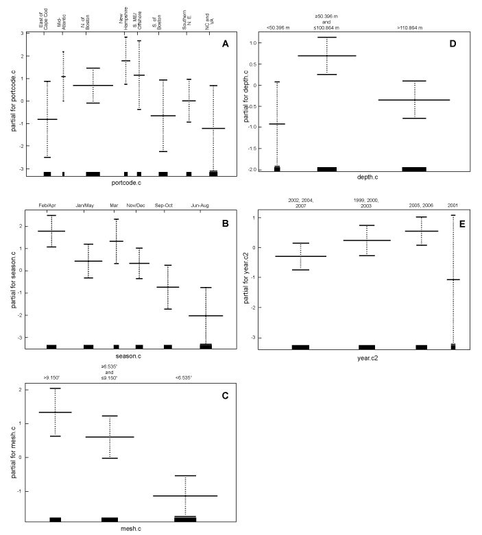
Fig. 3. GAM plots of the categorical variables used in the model (A) portcode.c, (B) season.c, (C) mesh.c, (D) depth.c, and (E) year.c, representing port group, season, mesh size, bottom depth, and year categories, respectively. The zero value on the y-axes represents an average bycatch rate of the plotted variable when accounting for the effect of other variables in the model. Areas above this line represent above average bycatch rates, while areas below zero on the y-axes represent below average bycatch rates. Note: Mid-Atlantic includes Maryland, Delaware, New York, and New Jersey effort west of 72˚30' W longitude; Southern N.E includes New Jersey, New York, Connecticut, Rhode Island, and Massachusetts effort east of 72˚30' W longitude and south of 41˚00' N latitude. Port grouping abbreviations include NC = North Carolina, S.ME = Southern Maine, Southern N.E. = Southern New England, and VA = Virginia. |
|