|
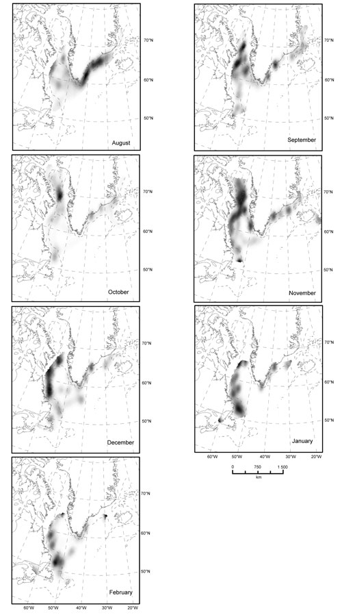
Fig 5. Kernel density surface map displaying areas of high-use by hooded seals in the NW Atlantic Ocean per month during the post-moult pre-breeding migration period (August–February) based on filtered uplink data. Dashed line is the 1 000 m contour line. Resolution is 20 km. |
|