|
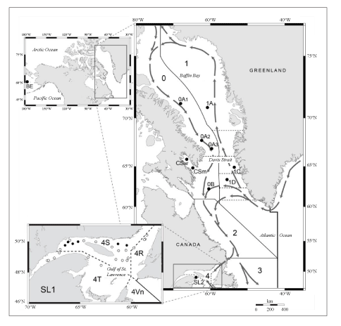
Fig. 1. Map showing sampling locations (refer to Table 1 for sample abbreviations) and NAFO Regulatory Subareas and Divisions. Arrows indicate the main deep-water currents. The inset at the bottom indicates the distribution of the samples collected in the Gulf of St. Lawrence between 18 August and 7 September 1994 (SL1). Full circles refer to multiple samples; open circles indicate collection of a single fish. |
|