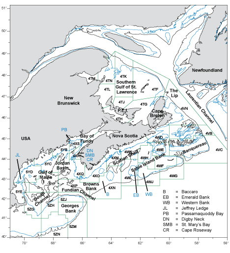
| Fig. 1. Map of the area relevant to haddock tagging studies in this paper. Common names of geographic features and the boundaries of DFO Statistical Unit Areas mentioned in the text are provided. The 100-meter (blue) and 200-meter (black) contour lines are used to distinguish major depth breaks. |